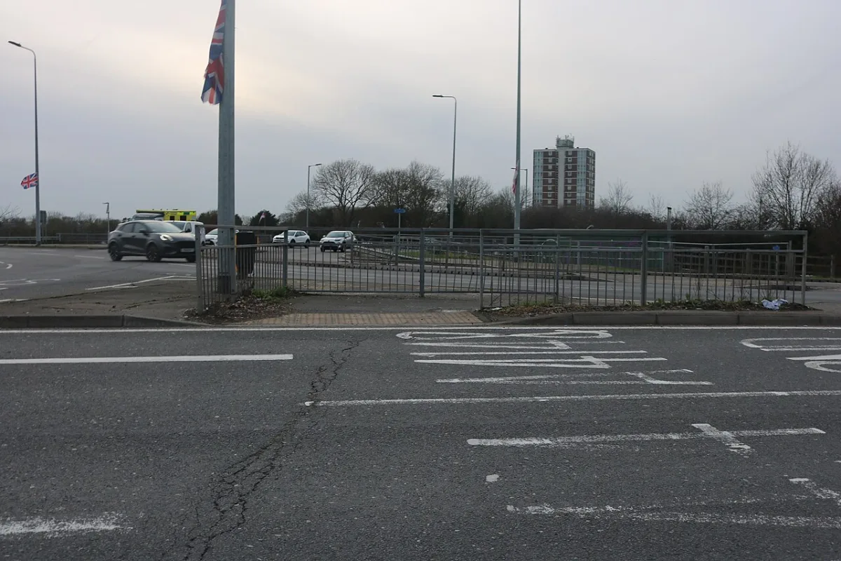

Eastwick Road is shut to 8 November, and the M11 J7 northbound exit slip closes for two months from 19 October. No trains through Harlow 17 to 18 October.
Two Harlow roads are shut this week, and two big closures are now in the diary for October: the M11 Junction 7 northbound exit slip, and a weekend with no trains.
This page lists every dated Harlow roadworks closure and train alteration we can verify from an official notice. It was checked again on Wednesday 30 September.
Eastwick Road has been closed since Monday 21 September and stays shut until 8 November. The signed diversion runs the long way, out through Sawbridgeworth and back via High Wych. The Hornbeams is shut to about 2 November for Cadent gas mains.
On the M11, Junction 7 is the one to diary. National Highways has given notice of a two-month closure of the Junction 7 northbound exit slip, starting on or after Monday 19 October, while an embankment is rebuilt. That is the slip most of Harlow uses coming home from London. This week’s motorway work is all at the London end.
There are no trains through Harlow on Saturday 17 and Sunday 18 October. Greater Anglia says buses replace trains between Stansted Airport and Waltham Cross that weekend.
An 18-month order in force from 24 September covers Southern Way and Kingsmoor Road. As with the First and Second Avenue order last month, it names no works and no contractor.
Harlow roadworks are split between four authorities, which is worth knowing before you complain to the wrong one. Essex County Council is the highway authority for every road in Harlow apart from the M11, which is National Highways. Hertfordshire County Council is the authority for Eastwick Road. Harlow Council runs the car parks. Knowing which is which saves a lot of time when you want to report something.
Dated closures, at a glance
| Road | From | For | Diversion |
|---|---|---|---|
| Eastwick Road | Mon 21 Sep, now closed | To 8 Nov | Via Sawbridgeworth and High Wych |
| The Hornbeams | Mon 21 Sep, now closed | 43 days, to about 2 Nov | Hodings Road and Rivermill |
| A414 west of Zelenskyy Avenue roundabout | Mon 21 Sep | About 15 weeks, single lane each way | Road stays open |
| M11 northbound J4 to J6 | Nightly to Fri 2 Oct | 10pm to 5.30am, Fri 11pm to 6am | Signed local diversion |
| Stony Wood footpath and cycleway | Mon 28 Sep | Ends Wed 30 Sep | Willowfield, FP 116, Third Avenue |
| M11 southbound J6 to M25 J27 link roads | Mon 5 Oct | 10pm to 5.30am | Signed diversion |
| Woodcroft | Wed 7 Oct | 3 days | None available |
| Brooklane Field | Mon 12 Oct | 3 days | Spinning Wheel Mead, Trotters Road, Southern Way |
| Trains, Stansted Airport to Waltham Cross | Sat 17 and Sun 18 Oct | All weekend | Rail replacement buses |
| M11 J7 northbound exit slip | On or after Mon 19 Oct | About 2 months | On to J7A, back south to J7 |
Eastwick Road, closed now until 8 November
This is the biggest change to Harlow’s road network this autumn, and it is not a council scheme. It is the second phase of Central Stort Crossing North, the transport works being built for the 10,000 homes planned in the Gilston area.
The developer delivering it, the Places for People and Barratt Redrow joint venture, has published the dates on its construction updates page:
“The road will be closed from 21 September through to 8 November 2026. A signed diversion will guide drivers via High Wych.”
The statutory order behind it is Hertfordshire’s, and it is more precise. It prohibits all vehicular traffic on Eastwick Road, Eastwick, from its junction with the A414 Fifth Avenue roundabout north eastwards to its junction with Terlings Avenue, about 697 metres. That roundabout is the one on Harlow’s northern edge. The order calls it the Fifth Avenue roundabout; the developer’s notice calls the same junction the A414/Zelenskyy Avenue roundabout, because Harlow Council renamed the road in 2023.
The wording still does not match. The developer describes an eastbound closure. The Hertfordshire order prohibits all vehicular traffic over that 697 metres. Treat it as shut in both directions and use the diversion.
The signed diversion is long:
- A414 Fifth Avenue and Edinburgh Way
- A1184 Cambridge Road and Harlow Road, through to Sawbridgeworth
- High Wych Road
- Pye Corner
- Eastwick Road
High Wych is a village in Hertfordshire, about three miles north east of Harlow town centre. The signed route reaches it the long way, out through Sawbridgeworth first, so this is a substantial detour rather than a block or two.
Two other things started on the same day and are still running. Temporary two way traffic lights are in at the Burnt Mill junction for BT diversion work, phased across a 16 week programme, with access kept to every home. Zelenskyy Avenue runs under two way signals between 21:00 and 05:30 while utilities are installed. The developer also says the A414 west of the roundabout is down to a single lane in each direction, 24 hours a day, for about fifteen weeks, while it builds a new south western site access.
The developer’s page still gives the end date for that lane closure as “01 January 2026”, which is before it started. Its own Central Stort Crossing section says the lane closures “will remain until early 2027”, and fifteen weeks from 21 September takes it to the first week of January 2027, so read it as that.
One detail residents of Pye Corner should know. The order temporarily suspends the 7.5 tonne weight limit on Eastwick Road and Pye Corner, from the A414 Fifth Avenue roundabout to Gilston Lane, about 973 metres, so lorries can use the diversion. (Hertfordshire County Council order, published by Eastwick and Gilston Parish Council)
We have covered the scheme, who is paying for it and how long it runs in a separate report.
The M11 this week: nothing at Junctions 7 or 7A
National Highways last updated its seven-day closure report at 15:30 on Tuesday 29 September. It covers 29 September to 5 October. Tuesday night’s closure of the Junction 7A northbound entry slip has now passed, and nothing else on the report touches Junction 7 or Junction 7A. These are the entries that affect a Harlow journey.
| Nights | Closure | Why |
|---|---|---|
| Wed 30 Sep and Thu 1 Oct, 10pm to 5.30am | Northbound Junction 4 to Junction 6: carriageway, entry slip, exit slip and link roads | Surfacing |
| Fri 2 Oct, 11pm to 6am | The same northbound Junction 4 to 6 closure | Surfacing |
| Mon 5 Oct, 10pm to 5.30am | Southbound Junction 6 link roads to the M25, both directions, at Junction 27 | Resurfacing |
The northbound surfacing is at the London end, from Woodford up to the M25, so it slows the drive home rather than the drive out. Monday’s closure is the one to watch if you head south late: the link from the M11 on to the M25 is shut in both directions that night.
Further north, the southbound Junction 13 entry slip is shut overnight to Friday and again on Monday 5 October, which is the Cambridge end. On Friday 2 October the Priorywood roundabout slips at Stansted, where the M11 meets the A120, close overnight from 9pm for cutting and planting. (National Highways, road closure report, 29 September to 5 October, checked 30 September)
Coming in October: the Junction 7 northbound exit slip, for two months
National Highways published notice on 24 September that it intends to close the exit slip road from the M11 northbound at Junction 7. The reason given is embankment reconstruction. The works are “expected to take place over 2 months starting on, or after, Monday 19 October 2026”.
This is the slip most Harlow drivers use coming home from London. While it is shut, the signed route is:
- carry on north on the M11 to Junction 7A
- turn round and come back south on the M11 to Junction 7
- leave there and continue your journey
The order comes into force on 12 October and can last up to 18 months, which is the legal ceiling rather than a forecast. The notice does not say whether the closure is round the clock or overnight only. Enquiries go to National Highways on 02380 628976. (Public Notice Portal, National Highways notice of 24 September)
Southern Way and Kingsmoor Road: a second 18-month order with no works named
Essex County Council gave notice on 17 September that it intends to make a temporary traffic order covering two more of Harlow’s distributor roads, in force from 24 September 2026 for up to 18 months:
- Southern Way, from its junction with Katerines Way to its junction with the A414 between the southern town boundary and the Harlow Mill roundabout, about 3,785 metres. Signed alternative: A414, A1025 and the A1169 Katherines Way.
- Kingsmoor Road and Paycock Road, from the junction of Katerines Way to the junction of Southern Way, about 890 metres. Signed alternative: the A1169.
It is titled Order (No.6) 2026, and it repeats the pattern we flagged in August. The notice says the roads “will be closed to facilitate each phase of works and then re-opened to the public”, and it never says what the works are. No contractor is named, no permit number is given, and no dates are set beyond the 18-month window. Every other closure in the same bundle names its utility and its reason.
Three and three quarter kilometres of Southern Way is a long stretch to hand over without a reason attached. What the order does do is impose a temporary no waiting, no loading and no stopping restriction on both sides of the road while a phase is running, suspending any existing parking bays on that length.
Essex County Council says the exact dates for each phase will appear on one.network, with residents told by letter or leaflet drop and advance warning signs on the road. The enquiries number on the notice is 0345 603 7631.
One small thing. The notice spells the same road “Katerines Way” in the road column and “Katherines Way” in the diversion column. The Harlow neighbourhood is Katherines. (Public Notice Portal, Essex County Council notice of 17 September)
There is one clue as to what has been happening on that road, although it comes from a different source and does not explain the new order. At Full Council on 17 September, Councillor Alastair Gunn asked what was being done about Southern Way, which he said had been closed three times in four years by burst water mains. The Leader, Councillor Dan Swords, replied that “three major incidents in four years is clearly unacceptable”, that the council is not the highway or water authority, and that “significant works have very recently been carried out on Southern Way, which we hope will address the problems that have caused these repeated incidents”. (Questions from Councillors, Full Council, 17 September 2026)
The Hornbeams, closed to about 2 November
Cadent Gas is replacing the mains in The Hornbeams, from its junction with Hodings Road to its junction with Herons Wood, about 205 metres. The closure started on 21 September and runs for 43 days, which on the scheduled dates takes it to about 2 November.
The signed route is Hodings Road and Rivermill, with access only into The Hornbeams. This is the closure to diary: 43 days is most of the autumn term, and the road is closed through rather than merely narrowed.
One small thing to know if you go looking for the notice. The council’s 3 September notice, which confirms the order has been made, spells the diversion road “Holdings Road”. The road is Hodings Road, as the council’s own 20 August notice had it. (Public Notice Portal, Essex County Council notice of 3 September)
Burntmill Lane, due to have reopened
Essex County Council’s order closed Burntmill Lane for about 10 metres, about 255 metres south east of the Eastwick Road junction, from 14 September for 14 days for bridge strengthening under permit EP20123270443. On those dates it was due back about Sunday 27 September. We found no later notice moving the dates, but we could not confirm on Wednesday that it has actually reopened. (Public Notice Portal, Essex County Council notice of 27 August)
Stony Wood footpath and cycleway, ends today
This one is for people on foot and on bikes rather than drivers. Essex County Council gave notice on 17 September that it intends to close two lengths of the shared footpath and cycleway at Stony Wood, in the south of the town, for sewer pipe repairs:
- from its junction with Stony Wood, north for about 228 metres
- from its junction with Westfield (BR52), south east then north east for about 563 metres
The closure is scheduled for 28 September to 30 September, so it should finish today. The signed alternative is Stony Wood, Willowfield, Footpath 116, the Third Avenue cycle trail and Second Avenue. The order comes into force on 28 September and can last six months, which is the life of the order rather than the length of the works. (Public Notice Portal, Essex County Council notice of 17 September)
Woodcroft, 7 October, three days, no diversion
Essex County Council has made the order closing Woodcroft, from its junction with Penlow Road for about 125 metres in a north westerly direction, for three days from Wednesday 7 October, under permit EP201EH2405647. The 17 September notice confirms the order, which came into effect on 10 September.
The work is carriageway patching by Essex County Council itself, and the notice again says no diversion route is available. Woodcroft and Penlow Road are both in Passmores, in the south of the town, so the alternatives are through the neighbouring estate roads. The order can run for 18 months, which is the life of the order rather than the length of the works.
Brooklane Field, 12 October, three days
Essex County Council gave notice on 10 September that it intends to close Brooklane Field, from a point about 35 metres south west of its junction with Southern Way, for about 510 metres. The closure is scheduled for three days from Monday 12 October, for duct laying by Openreach under permit BC008WH2WV2RL2CSB.
The alternative route is Brooklane Field, Spinning Wheel Mead, Trotters Road and Southern Way.
The length has changed between notices. The 10 September notice of intent gave about 510 metres. The order as made, confirmed in the 24 September notice, gives about 50 metres, and quotes the permit as BC008WH2WW22RL2CSB. The shorter figure is the one in force. (Public Notice Portal, Essex County Council notice of 24 September) (Public Notice Portal, Essex County Council notice of 10 September)
The same notice carries a short closure on Epping Road in Roydon, the village about three miles west of Harlow town centre: three days from 12 October near Low Hill Road, for Affinity Water. The signed route comes through Harlow on the A1169.
A414 towards Chelmsford: temporary speed limits to become permanent
Essex County Council proposes to make permanent the temporary limits now on the A414 east of Harlow, out towards Chelmsford. The Talbot roundabout at North Weald, about five miles south east of Harlow, is where the first length starts. The proposal includes:
- 40mph instead of 60mph on High Road and Epping Road for about 2,334 metres east of the Talbot roundabout
- 40mph instead of 50mph on Epping Road near Stony Lane, Ongar, for about 1,830 metres
- 50mph instead of 60mph for about 14.7 kilometres from east of the Four Wantz roundabout at Ongar towards Chelmsford
Objections, with reasons, go to TrafficRegulation.Order@essexhighways.org quoting TRAF/8937, by 16 October 2026. The plans are on the Essex Highways traffic orders page. (Public Notice Portal, Essex County Council notice of 24 September)
Objections closed: no stopping at any time in two Harlow cul-de-sacs
Colchester City Council, acting for the North Essex Parking Partnership, has proposed double red lines in two residential turning areas in the west of Harlow, at Staple Tye and Hare Street. Double red lines mean no stopping at any time, not just no waiting. The proposal covers:
- the access road and the cul-de-sac serving 235 to 245 Jerounds
- the cul-de-sac containing numbers 3, 4 and 4a Cock Green, off Three Horseshoes Road
It would be added to the Essex County Council (Harlow District) civil enforcement consolidation order as Amendment No. 89, reference HDC89. The objection period closed on Sunday 27 September, and no decision notice has been published yet. (Public Notice Portal, Essex County Council notice of 3 September)
Already running
First Avenue, Second Avenue and Pyenest Road: the 18-month order
Essex County Council made the order covering three of Harlow’s biggest roads on 27 August, in force from 20 August 2026.
| Road | Extent | Length | Signed diversion |
|---|---|---|---|
| First Avenue | Fifth Avenue to the A414 | about 2,315m | A414, Edinburgh Way, Fifth Avenue |
| Second Avenue | Third Avenue to the A414 | about 1,940m | A414, Edinburgh Way, A1019 |
| Pyenest Road | Kingsmoor Road to Abercrombie Way | about 695m | Kingsmoor Road, A1169, Abercrombie Way |
Two things have not changed, and the new Southern Way order repeats both of them. The notice still does not say what the works are, naming no contractor and no reason, while every other closure in the same bundle names its utility. And the 18 months is the life of the order, not the length of any one closure: the roads shut in phases, and the council says “exact dates will be specified on one.network”, with residents told by letter or leaflet drop and advance warning signs.
While a phase is running, both sides of the road carry a temporary no waiting, no loading and no stopping restriction, and existing parking bays on that length are suspended. Access is kept for emergency services. (Public Notice Portal, Essex County Council notice of 27 August). We have covered this order in full in a separate report.
Footway repairs, Pennymead and Quarry Springs, to end of October
Phase one of a footway maintenance programme began on 6 July 2026 and covers Pennymead and Quarry Springs. Essex Highways says it aims “to complete our improvement programme by the end of October 2026”. Phase two, dates still to be announced, covers Cooks Spinny. Checked again on 30 September.
The work levels surfaces and fixes kerbs ahead of a separate slurry sealing programme later. Traffic is mostly managed on a give and take arrangement with marshals on site, and clearways or no-parking restrictions apply on the street being worked on, so residents in those roads need to park elsewhere on their day. Essex Highways says people directly affected are contacted individually, and that “dates may be subject to change if the works are affected by poor weather”. (Essex Highways, Harlow footway repairs)
Two cycleways shut until February
Two orders that took effect on 16 August 2026 close cycle routes on the east side of the town for resurfacing, and both may run to 16 February 2027:
- The Old London Road cycletrack, from the Old London Road carriageway north east for about 117 metres to the London Road cycletrack. Diversion via Old London Road, Second Avenue, the A414, Church Langley Way and London Road.
- The Church Langley cycletrack and footway, from London Road north then north east for about 425 metres. Diversion via London Road and Church Langley.
Six months is the maximum the order allows, not a forecast, so they may reopen sooner.
Seven roads in the south of the town, over 18 months
The earlier programme of temporary closures, weight restriction changes and new clearways across the Harlow and Epping Forest districts is still running in phases from 22 January. The Harlow roads named are Little Pynchons, Pear Tree Mead, Parnall Road, Paringdon Road, Partridge Road, Tendring Road and Ployters Road.
During each phase the affected road carries strict no waiting, no loading and no stopping restrictions, with diversions signed at each location. The exact dates for each road are published on one.network rather than in the order itself. If you live on one of those seven, watch for the yellow notices going up on the lamp posts.
Trains: no trains through Harlow on 17 and 18 October
Greater Anglia’s alterations calendar was checked again on 30 September, for the rest of this week and for October. One weekend closes the whole line through Harlow.
| Dates | What | Where |
|---|---|---|
| Wed 30 Sep and Thu 1 Oct, late night | The 23.28 Liverpool Street to Cambridge is a bus from Bishop’s Stortford | Stansted Mountfitchet to Cambridge |
| Sun 4 Oct | The 23.54 Liverpool Street to Bishop’s Stortford runs via Seven Sisters, a few minutes slower | South of Harlow |
| Sat 17 and Sun 18 Oct | Buses replace trains | Stansted Airport to Waltham Cross, and Hertford East to Waltham Cross |
| Mon 19 to Sun 25 Oct | Buses replace trains | Hertford East to Broxbourne |
The 17 and 18 October weekend is the one that matters. Harlow Town and Harlow Mill both sit on the closed stretch, so any journey that weekend starts on a bus. Greater Anglia says trains still run between Waltham Cross and London, but only half-hourly, and between Stansted Airport and Cambridge. Tickets are also accepted on Great Northern and Thameslink between Cambridge and London King’s Cross. (Greater Anglia, Stansted Airport and Hertford East to Waltham Cross)
This week’s late-night change is north of us: the last train to Cambridge still calls at Harlow, and becomes a bus from Bishop’s Stortford onwards. (Greater Anglia, service alterations)
Parking: three orders from August
Harlow Council and the North Essex Parking Partnership each changed the parking rules in August, and all three are now settled:
- New disabled bays at five estates. The council made an order on 20 August adding disabled parking places at Five Acres, Longbanks, The Dashes, Dunstalls and Tithelands. The sealed order can be inspected at the Civic Centre. (Harlow District Council Off-Street Parking Places (Amendment No. 12) Order 2026)
- Permit parking proposed at Potter Street. A second order, still at proposal stage, would add permit-controlled parking places at Potter Street, east of the 13 to 43 garage area. Objections go in writing to the Civic Centre or to parking@harlow.gov.uk. (Amendment No. 13 Order 2026)
- More blue badge bays in West Gate, live since 31 August. Colchester City Council, acting for the North Essex Parking Partnership, made an order adding disabled badge holder bays in West Gate. It came into force on 31 August 2026.
The corridor that is finished
Harlow’s first Sustainable Transport Corridor is complete. It runs from a rebuilt junction at Burnt Mill along the A1019 to the town centre, and it took from March 2024 to 2026 to build, with Bouygues UK as principal contractor and Colas on site.
What Harlow got for it, according to Essex Highways:
- A new southbound bus lane on Zelenskyy Avenue connecting Harlow Town station to Harlow bus station.
- Road widening on First Avenue and Post Office Road, and a reduced central island on the Velizy Roundabout with the inner ring now surfaced.
- New footway and cycleway along First Avenue from The Hides, and a no-dig footpath along Zelenskyy Avenue.
- A rebuilt pedestrian crossing between the town centre and Harlow College.
- A reconfigured Hammerskjold Road junction at the Sainsbury’s roundabout.
- New signals, lighting, signage, surfacing and planting throughout.
It is the first of a planned group of corridors, and it is part of Homes England’s £172 million Housing Infrastructure Grant investment in Harlow, put in place to get transport built before the Harlow and Gilston Garden Town’s new homes arrive rather than after. The stated target is for 50% of journeys from existing Harlow communities to be made sustainably.
Two walking and cycling schemes finished alongside it. LCWIP 9, a £2 million east to west route from the Pinnacles industrial area to the town centre, was completed in October or November 2024. LCWIP 4 delivered three new crossings on the First Avenue corridor, a raised table at the Park Lane junction, a toucan crossing on the northern arm of the Howard Way roundabout and a parallel crossing over Momples Road, and was finished in summer 2026.
The routes that carry Harlow
Harlow’s road layout is unusual because it was designed rather than grown. The town sits inside a ring of fast roads with the neighbourhoods hanging off them, which means there are very few alternative routes when one of the main links shuts. That is worth remembering when a diversion adds twenty minutes to a five-minute journey, and it is why two of this autumn’s closures carry no diversion at all.
M11 Junction 7a is the newest piece and the one that changed the most. It opened in June 2022, built by National Highways and Essex County Council, and it gives east Harlow a direct link onto the motorway via a widened three-lane Gilden Way, instead of routing that traffic through the town to Junction 7. If you are coming from Church Langley, Newhall or Old Harlow, J7a is almost always the right junction.
Parking
Harlow Council owns and maintains 14 car parks. They are grouped by area:
- Town centre: Wych Elm
- Town Park: Altham Grove, Burnt Mill Lock, First Avenue (Tanyard Place), School Lane, Showground (Fifth Avenue)
- Old Harlow: Garden Terrace Road, Wayre Street
- Bush Fair: Tawneys Road, Tilegate Road
- The Stow: Minchen Road, The Stow
- Mark Hall: Mill Hatch, River Way
Charges are shown on site rather than published as a single tariff list, so check the signs or the machine. The council’s car parks page has a map and the full postcode for each.
For rail travel, Harlow Town station has 649 spaces including 18 accessible bays, and Harlow Mill has 31. Cineworld at Queensgate on Edinburgh Way has free parking near the cinema; the Harvey Centre car park in the town centre charges.
Public transport when the roads are bad
If a closure is going to make driving painful, the alternatives are genuinely usable in Harlow, which is not true of every town this size.
- Rail. Harlow Town runs every ten minutes or so to London Liverpool Street off-peak, 31 minutes at best. Full times and fares are in our guide to Harlow trains to London.
- Bus. Harlow bus station is in the town centre, and the new southbound bus lane on the A1019 links it directly to Harlow Town station.
- Walking and cycling. The LCWIP 9 route from the Pinnacles to the town centre and the rebuilt A1019 corridor are both segregated for most of their length.
Lifts. We could not confirm the live lift status at Harlow Town station when we checked, because National Rail publishes it dynamically rather than on the station page, so check the station page before you rely on one.
How to check before you travel
Roadworks change at short notice and no page can stay current between updates. These are the live sources:
- one.network shows every permitted road closure and street works in Essex and Hertfordshire, including the exact dates for the 18-month programmes above. It is the source Essex Highways itself points people to.
- Essex Highways live traffic map for current conditions, and the future roadworks map for what is coming.
- National Highways for the M11, which Essex County Council does not manage.
- construction@gilston.info or 01279 805222 for the Central Stort Crossing works on Eastwick Road, Burnt Mill and Zelenskyy Avenue.
- Report a pothole or a highway problem to Essex Highways, not to Harlow Council. Parking and car parks are the council’s.
We update this page as Essex Highways, Hertfordshire County Council and National Highways publish new Harlow schemes.
Sources
- National Highways, road closure report, 25 September to 1 October 2026, last updated 25 September at 15:30 and checked 27 September, for the Junction 7A northbound entry slip on 29 September, the Junction 4 to Junction 6 northbound surfacing nights and the Junction 13 southbound entry slip closures.
- Public Notice Portal, National Highways notice of 24 September 2026 for the two-month Junction 7 northbound exit slip closure from on or after 19 October.
- Public Notice Portal, Essex County Council notice of 24 September 2026 for the A414 speed limit proposal (TRAF/8937) and the made Brooklane Field order.
- Questions from Councillors, Full Council, 17 September 2026 for Councillor Alastair Gunn’s question on three Southern Way closures in four years and the Leader’s reply.
- Public Notice Portal, Essex County Council notice of 17 September 2026 for the Southern Way and Kingsmoor Road Order (No.6) 2026 in force from 24 September, the Stony Wood footpath and cycleway closure from 28 to 30 September, and the confirmation of the Woodcroft order.
- Public Notice Portal, Essex County Council notice of 10 September 2026 for the Brooklane Field closure from 12 October and the two Epping Road, Roydon closures.
- Gilston Park Estate, construction updates for the Eastwick Road closure dates of 21 September to 8 November 2026, the High Wych diversion, the Burnt Mill two way signals and 16 week programme, the Zelenskyy Avenue night working hours of 21:00 to 05:30, and the fifteen week single lane closure on the A414 from 21 September.
- Hertfordshire County Council temporary traffic management order, published by Eastwick and Gilston Parish Council for the exact extent of the Eastwick Road closure, the full signed diversion, and the temporary suspension of the 7.5 tonne weight limit through Pye Corner.
- Epping Forest District Council, Central Stort Crossing works to begin for the scheme’s delivery partners, the Homes England funding and the Hertfordshire County Council administration.
- Public Notice Portal, Essex County Council notice of 3 September 2026 for the Woodcroft closure from 7 October, the confirmation that The Hornbeams order has been made, and the North Essex Parking Partnership Amendment No. 89 proposal for Jerounds and Cock Green.
- Public Notice Portal, Essex County Council notice of 27 August 2026 for the First Avenue, Second Avenue and Pyenest Road order, and for the Burntmill Lane closure from 14 September with no diversion.
- Public Notice Portal, Essex County Council notice of 20 August 2026 for the original The Hornbeams notice and the Old London Road and Church Langley cycletrack orders.
- Essex Highways, Harlow footway repairs in preparation for slurry treatment for the Pennymead, Quarry Springs and Cooks Spinny programme, the 6 July 2026 start and the end of October target.
- Greater Anglia, service alterations for the engineering calendar to 2 October, checked 27 September.
- Harlow District Council Off-Street Parking Places (Amendment No. 12) Order 2026 and (Amendment No. 13) Order 2026 for the new disabled bays and the Potter Street permit parking proposal.
- Essex Highways, Harlow Sustainable Transport Corridors for the completed A1019 corridor, the scheme contents and the £172 million Homes England grant.
- Harlow Council, road officially renamed after Ukrainian President for the renaming of Fifth Avenue as Zelenskyy Avenue.
- Essex Highways, M11 Junction 7a for the June 2022 opening and the Gilden Way widening.
- Harlow Council, car parks for the 14 council car parks and their locations.
- National Rail, Harlow Town station for parking and the current lift status.
Closures and dates change at short notice. Checked on 27 September 2026. Always confirm on one.network or the Essex Highways live map before you travel.
More Harlow local information: house prices, trains to London, planning news and things to do in Harlow.
Have your say